Britain's Best Car Journeys
Hit the Road: Explore the best of Britain on a scenic drive
Daniel Allen
According to Buddha, "happiness is a journey, not a destination." What better way to test the enlightened one's theory than on a road trip somewhere in the picturesque British Isles?
Britain has over 200,000 miles of road ready to explore. Despite the horrible reputation of some of its motorways, many of these are both empty of traffic and surrounded by glorious landscapes. In fact, driving through the right parts of the British countryside at the right time can be one of life's true pleasures.
An excellent network of rural roads gives drivers (and riders) in Britain access to some of the most magnificent scenery in the world. Whether you're hankering after mountainous landscapes, gently rolling countryside or sweeping coastlines, road tripping is one of the best budget-friendly ways to see the country.
If you've got wheels - be it a hire car, camper or Harley Davidson - here are some of Britain's finest stretches of tarmac.
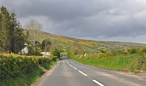
Causeway Coastal Route, Northern Ireland
Regarded as one of the world's prettiest coastal roads, the Causeway Coastal Route is an absolute must for any visitor to Ireland - north or south. Taking in pristine beaches, photogenic castles and areas of outstanding beauty, the 120-mile (190-km) route stretches from Belfast to Lough Foyle.
The route, which hugs the coastline from Belfast to Londonderry, can be driven in a day, but savvy travellers take at least two or three days, leaving plenty of time to savour that famous Irish hospitality. Highlights include patchwork-quilt countryside, picturesque fishing villages, golden sands, towering cliffs and silent glens, not to mention the World Heritage Site of the Giant's Causeway.
www.discovernorthernireland.com/causeway
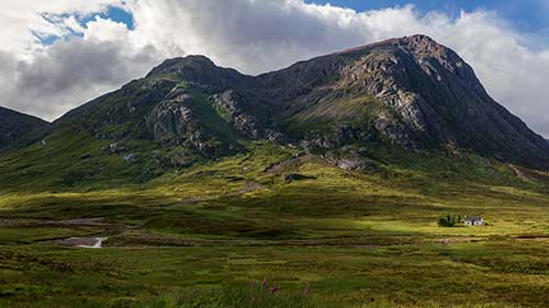
Into the Scottish Highlands on the A82
Scotland is renowned for its many absorbing driving roads and this Highland route is a classic. The 108-mile road from Glasgow to Fort William - often called the gateway to the Highlands - takes in some of Scotland's most famous, dramatic and historic landscapes. While it can be driven in a few hours, it's well worth giving the journey a whole day because there's so much to take in and photograph.
Leaving the suburbs of Glasgow far behind, drivers are soon surrounded by the lush greenery and soaring, snow-capped peaks of Scottish Highland scenery. The road hugs the shore of Loch Lomond, then passes through the Trossachs National Park and Glen Coe, and along the shore of the enormous Loch Linnhe. It finishes in Fort William, with tantalizing glimpses of Ben Nevis, the tallest mountain in the British Isles (1,344m), on the right.
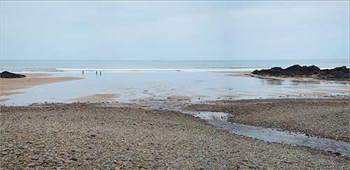
The Atlantic Highway, Devon & Cornwall
The Atlantic Highway, also known, somewhat less romantically, as the A39 (or part of it), technically stretches 76 miles (122 km) from Barnstaple in north Devon to Fraddon, a Cornish village close to Newquay. However, many choose to begin their journey in Bath, where the eastern end of the A39 actually starts.
Those that begin their journey in Bath get to appreciate much of Exmoor National Park - a vast area of open moorland - en route to Barnstaple. The highway proper, which takes in the folds of Devon's rich farmland and the rolling acres of north Cornwall, hugs much of the coast, offering fantastic views of land and open ocean.
Sights to see on the way include Constantine Bay and the Bedruthan Steps, while the the route passes through plenty of quaint coastal villages, such as Tintagel, legendary birthplace of King Arthur. With only four major towns - Barnstaple, Bideford, Bude and Camelford (plus the odd combine harvester) - to negotiate, it's a blast from start to finish.
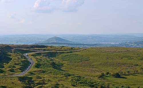
The Black Mountain Pass, Wales
Wales boasts numerous scenic road trips - this majestic mountain road, which peaks at 493m (1617 ft), is one of the best. Only 21 miles (33 km) long, it more than makes up for its lack of length with awe-inspiring Brecon Beacons scenery, spectacular views of the Tywi Valley, and enough hairpin bends and switchbacks to evoke a drive over the Swiss Alps.
Following the A4069 northward the whole way, the Black Mountain route starts in the village of Gwaun-Cae-Gurwen and ends in the market town of Llandovery, taking about 45 minutes to drive. The best views of the Tywi Valley are enjoyed travelling south-north, while the spectacular Carreg Cennen Castle lies a few miles to the west, with Dinefwr Castle and the idyllic market town of Llandeilo a few miles beyond that. Watch out for roaming sheep!
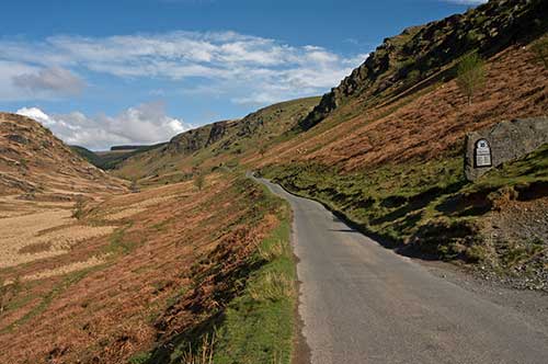
Close to the Black Mountain Pass lies another recommended (and even shorter) Welsh road trip - the Abergwesyn Mountain Pass route - which runs 18 miles (29 km) between the villages of Abergwesyn and Tregaron. From the riverside hamlet of Abergwesyn the route follows the winding thread of an ancient cattle-drovers' road up the perilous Devil's Staircase (a collection of acute hairpin bends) and through dense conifer forests to miles of wide, desolate valleys, before descending down through the Cambrian Mountains into Tregaron.

The Cat and Fiddle (A537)
This 12-mile (20-kilometre) road links Buxton in Derbyshire to Macclesfield in Cheshire, encompassing the A53, A54 and A537. It is extremely popular with motorcyclists, and is often classed as the most dangerous road in Britain. However, it is also rightly famous for its fantastic views over Greater Manchester, the Peak District National Park and the Cheshire Plain.
This route is named after the Cat and Fiddle Inn at the road's summit, which is the second highest pub in England. While the route can be completed in 30 minutes, many choose to break up the journey with liquid or culinary refreshment at the top (unfortunately the Cat and Fiddle is temporarily closed). Those driving this route should keep an eye on their speed as the tight bends can be tricky to negotiate.
North Coast 500
Scotland now has its very own take on America's legendary Route 66. Launched in mid-2015, the North Coast 500 - or "NC500" - is now attracting growing numbers of cyclists, hikers, bikers and drivers, and is already being ranked alongside some of the world's other great coastal road journeys, such as the Amalfi Coast in Italy and Norway's Atlantic Road.
The NC500 route starts in Inverness, follows the A835 towards the west coast, and hugs the coastline upward through the north west Highlands, across the very top of mainland Britain, and finally down the east coast on the A9 from Britain's most northerly village, John O'Groats, completing the loop back to Inverness. Those making the journey can anything from a long weekend to a couple of weeks to explore this little slice of Scottish heaven.