South Yorkshire Supertram (Sheffield Supertram)
Sheffield Supertram
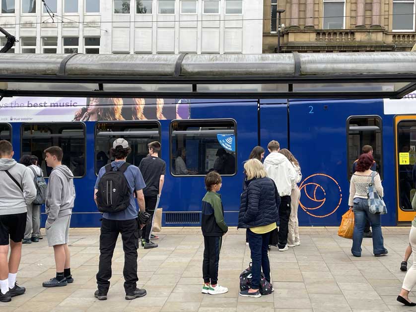
The South Yorkshire Supertram (Sheffield Supertram) is a light rail network that operates 4 lines in the Sheffield and Rotherham areas of South Yorkshire. Each line serves different parts of Sheffield and its neighboring suburbs, connecting key destinations such as Sheffield City Centre, Meadowhall shopping centre, Sheffield railway station, and the University of Sheffield.


History
The network opened in 1994 with three lines (Blue Route, Purple Route and Yellow Route) after several years in the planning stage. In 2018 the Tram Train Route opened. There are now 50 stations on the entire network.
The network was privatized with Stagecoach from 1997 until 2024 when it returned to public ownership.

Lines & Stations
There are 4 lines on the network: Tram Train, Blue Route, Purple Route and Yellow Route.
Tram Train Stations
Cathedral (for Sheffield Cathedral)
Castle Square
Fitzalan Square / Ponds Forge
Hyde Park
Cricket Inn Road
Nunnery Square
Woodbourn Road
Attercliffe
Arena / Olympic Legacy Park
Valley
Centertainment
Carbrook for IKEA
Meadowhall South / Tinsley
Rotherham Central
Rotherham Parkgate

Blue Route
Malin Bridge
Hillsborough Interchange
Bamforth Street
Langsett / Primrose View
Infirmary Road
Shalesmoor for Kelham Island
Netherthorpe Road
The University of Sheffield
West Street
City Hall
Cathedral
Castle Square
Fitzalan Square / Ponds Forge
Sheffield Station (Sheffield Hallam University)
Granville Road (Sheffield College)
Park Grange Croft
Park Grange
Arbourthorne Road
Spring Lane
Manor Top
Hollinsend
Gleadless Townend
White Lane
Birley Lane
Birley Moor Road
Hackenthorpe
Donetsk Way
Moss Way
Crystal Peaks Interchange
Beighton
Waterthorpe
Westfield
Halfway
Purple Route
Cathedral
Castle Square
Fitzalan Square / Ponds Forge
Sheffield Station (Sheffield Hallam University)
Granville Road (Sheffield College) - for Bramall Lane Stadium
Park Grange Croft
Park Grange
Arbourthorne Road
Spring Lane
Manor Top
Hollinsend
Gleadless Townend
Herdings / Leighton Road
Herdings Park
Yellow Route
Middlewood
Leppings Lane (for Hillsborough Stadium)
Hillsborough Park
Hillsborough Interchange
Bamforth Street
Langsett / Primrose View
Infirmary Road
Shalesmoor for Kelham Island
Netherthorpe Road
The University of Sheffield
West Street
City Hall
Cathedral
Castle Square
Fitzalan Square / Ponds Forge
Bus Interchange (Sheffield)
Hyde Park
Cricket Inn Road
Nunnery Square
Woodbourn Road
Attercliffe
Arena / Olympic Legacy Park
Valley Centertainment
Carbrook for IKEA
Meadowhall South / Tinsley
Meadowhall Interchange

Trains
Stadler Citylink (Class 399) tram-trains manufactured in Spain run on the Tram Train Route. German Siemens-Duewag Supertrams operate on the Blue Route, Purple Route and Yellow Route.
Terminuses & Intersecting Stations
The main intersecting stations are Cathedral, Castle Square and Fitzalan Square / Ponds Forge where all 4 lines intersect.
Terminuses are Meadowhall Interchange and Middlewood (Yellow Route); Herdings Park and Cathedral (Purple Route); Halfway and Malin Bridge (Blue Route); Rotherham Parkgate and Cathedral (Tram Train).
Tickets
Adult Single - Short Journey £2.40; return £4.00; Adult Single - Longer Journey £2.80; Child Flat Fare (Zoom Under 16 or Zoom 16-18 pass required) £1.00; return £2.00; Adult Tram Day £5.40; £5.00 on the App; Adult Tram 7 Day £19.00; £17.50 on the App; Adult Tram 28 Day £58 on the App.
Bicycles
Currently only folding bicycles are allowed on trams but a review is underway.
Information
Customer Liaison Team
South Yorkshire Mayoral Combined Authority
11 Broad Street West
Sheffield
S1 2BQ
Tel: 0800 952 0002
www: travelsouthyorkshire.com
Network Map & Map of Sheffield


Related
Docklands Light Railway (DLR)